")


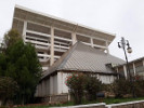
Presentation of the town:
It is 470 m a bove sea level, located on the Mekerrathe center of a vast plain between the Djebel Tessala north and the mountains of Dayain the South.SidiBel Abbes was known asbaseof the 1st Regimentof the Foreign Legion. SidiBel Abbeswas built by the Frenchona grid patternina rectangular enclosure, pierced with fourdoors,indicating the cardinalpoints.A1.5 km fromthe center is themar about of Sidi-Bel-Abbes, is that ofaholy manin the line of descendants of the Prophet and son of Sidi El Bouzidi who lived in the 18th century, which left throughout the region and are vered memory spawned wonderful legends.
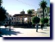
Historical Overview:
The city wasbuilt by theLegionariesin 1843onthe banks of theMekkerabecause itis astrategic andwell-drainedlocation.This is thecaptain of engineerswho designedPrudonthe city.Like all citiesdesigned by thegeniusmélitaire, Sidi-Bel-Abbes was built ona grid planwith fortificationsand gatesat each corner.Its creation wasformalizedby a decreeof the Statedated January 5,1849.His firstname was Biscuit City and in 1859 it took the name of Bel-Abbes Napoleona very short time to become Sidi-Bel-Abbes the name of aWaliullah "Sidi BelAbbes Bouzidi."
Geostrategic position of the town:
- Crossroads oftheWestregion,Wilaya deSidi BelAbbesis located at:
- 80 km Oran and Tlemcen.
- 60 km from Mascaraand Temouchent.
- 150Km of Mostaganem.
- 160Km of Mechria.
- 100 km from Ras Elma, administrative district of the Wilayaand important military base.
- By means oftheEast-West Highway, Sidi BelAbbes is less than40 minutes from two internation alair ports (Senia, Oran and Zenatta, Tlemcen).
- By means ofrailwayhighland, Sidi BelAbbesiseasily accessible for Wilayas South.
- Due toits advantages,the wilaya of Sidi BelAbbes becomes the strategic junction between different neighboring wilayas.